Mt. Kurobi - First Real Mountain Trek Experience
June 12, 2023•934 words
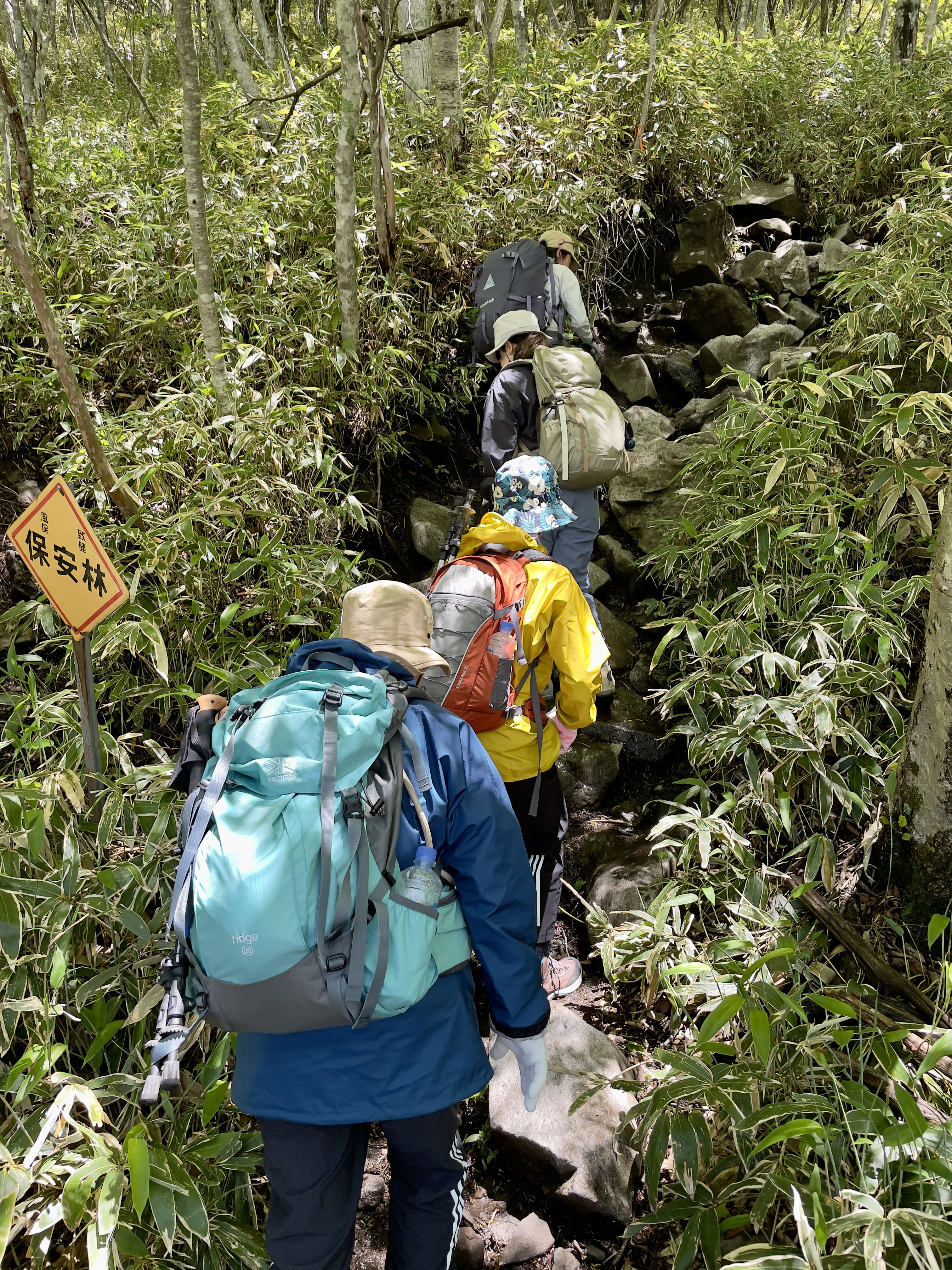
On Saturday 3rd June 2023, I had my first real mountain trekking experience, and I got to discover how out of shape I really am. We went up Mt. Akagi, aka Mt. Kurobi, in Gunma Prefecture; one of the 100 famous mountains of Japan (English) or 百名山 "hyakumeisan". During the trek, I asked our guide why Akagi's considered a "beginner mountain", and she said it's because there are not many areas where you'd risk death. Right. 😰
I have done some trail hiking in Kamakura and the Miura Alps, but our daughter who has been climbing progressively harder mountains, said "that's just hiking, not mountain climbing", and encouraged us all to go up an easy mountain together. Not wanting to wuss out in front of my daughters or wife, we booked a guided tour via Club Tourism, and off the four of us went.
Mt. Akagi was apparently formed as a result of a volcanic eruption 10s of thousands of years ago. You take a bus up to the visitor center at Lake Ono, at about 1,300 m, and climb up to the summit at 1,828 m (5,997 ft). You can read about its history on Wikipedia (English) or see Maebashi City's informative (English) page on it.
A typhoon had passed through Yokohama the night before, and we thought surely the tour would get cancelled, but there was no such message as of evening the night before, so we got up around 4am Saturday, and made our way to Yokohama station, then to the Bay Quarter where the bus was going to pick us up at 7am. We got underway exactly on time, because Japan, but there was an accident on the highway, causing us and everyone else to have to reroute, which lost us about 2 hours. We were due to start climbing in the AM and summit at around noon, but we ended up starting up at noon. Fortunately, the weather had broken and it was sunny, if a little chilly, at the visitor area. We had a toilet break, got laced up and did some group stretching to limber up.
From the trail head near the bus stop to the summit, it's a steep uphill climb for ~100 min. The terrain is rocky, with a lot of small boulders and rocks between and on which you climb. There are a few lovely views on the way up, where you can see Lake Ono and a smaller sister lake. The route was full of flowering trees, which are a colorful respite from all the rocks.
At first I thought it's only about 500m elevation change, how hard could it be? But, it was plenty hard. Especially if you're a middled aged guy like me who mostly does light jogging and walking the dog. I do a lot of that, but this climb was more like doing 1000 squats. Ms. Okubo, our mountain guide, spent years in the Himalayas and was really knowledgable, and just built different physically. It felt much safer climbing up with her there to support us. 🙏🏻
As we climbed it got colder, and on one of the short breaks we added a layer. Once we got to the summit, it was quite cold, maybe about 10C in temp but feeling way colder due to the strong wind. The summit has a sign to go two minutes down the trail to the point where the view is better, and while the view was indeed spectacular, it was freezing. More layers! The summit was the less windy of the two spots, so it was there we scarfed down our onigiri balls and protein bars, then we got on our way after maybe 20 min.
The next stop was Komagatake, a smaller peak on the way back to the visitor center, so you go down a bit then back up. We were there for 10 min, then it was all descent to the visitor center again. The way down is steps - lots and lots of steps, made from wood, rock or steel. I was thinking as I slogged down them how I admired the people who installed those steps. Must have been a really hard and long job to do it. Okubo san said the steel steps are dicey in the rain, so I was just grateful it was dry already.
Partway down my knees and legs were just spent, and I was having a lot of trouble and pain. It was a great experience and one I hope to repeat, but I have to figure out how to better bullet proof my knees!
Regarding the level of difficulty in general, I guess the Japanese word "tozan" 登山 implies hiking up to the peak of one of the many, many mountains in Japan, and then hiking back down. This qualifies as that, and was different from hiking in, say, the Miura Alps or Kamakura. Indeed, Mt. Akagi / Kurobi is just a trek, albeit a steep one, and there were just a few areas where we were cautioned not to get close to the edge because a fall would mean serious injury or death. But there are certainly no terrifying areas on this hike, and nothing technical like rope work.
At any rate, if you're interested, you can see our route, from my Yamap activity URL and a saved Google Maps map. Maybe we'll see you out there some time! 🌋
