Zushi to Kita-Kamakura 10km Trek
July 18, 2023•940 words
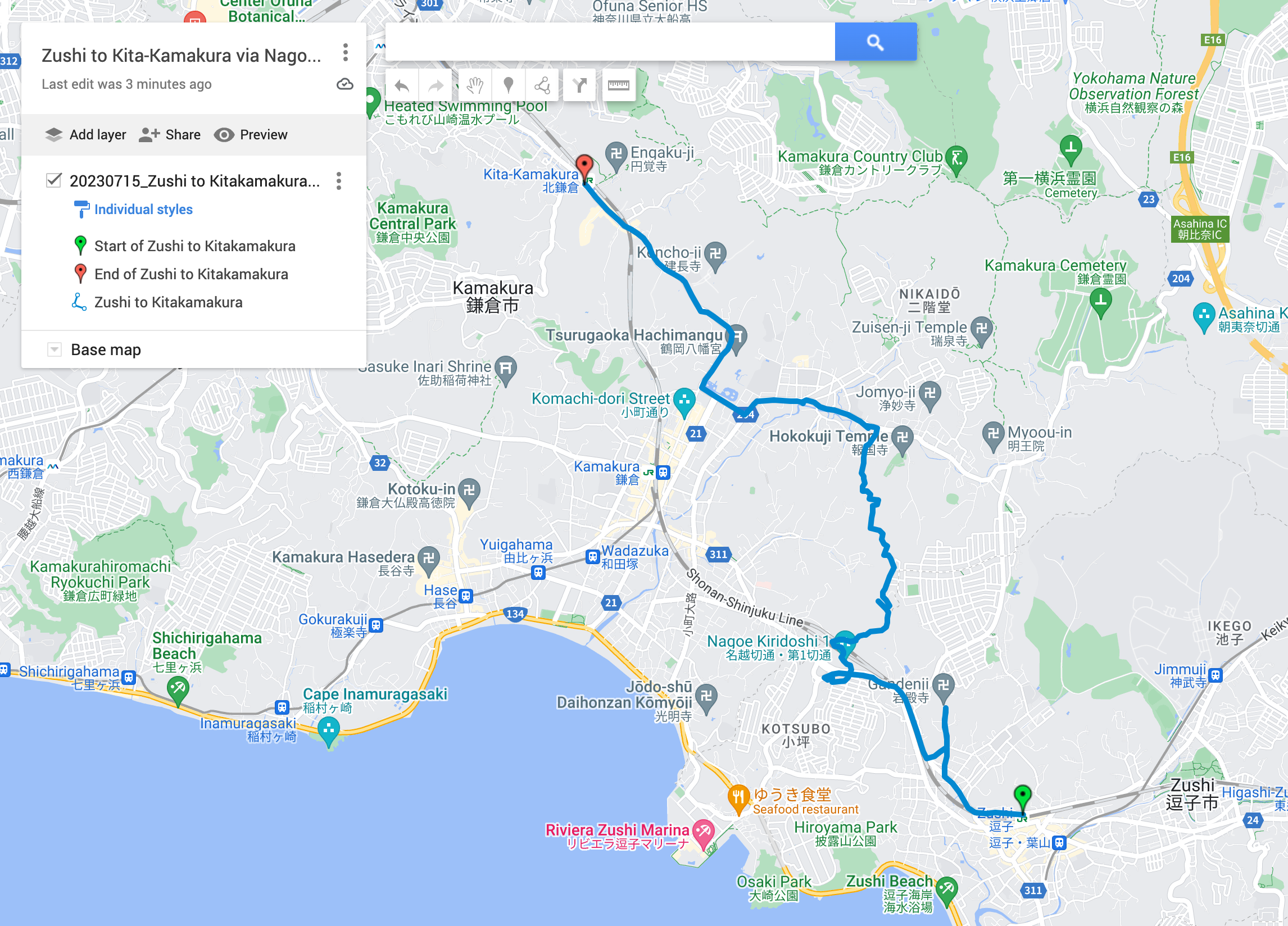
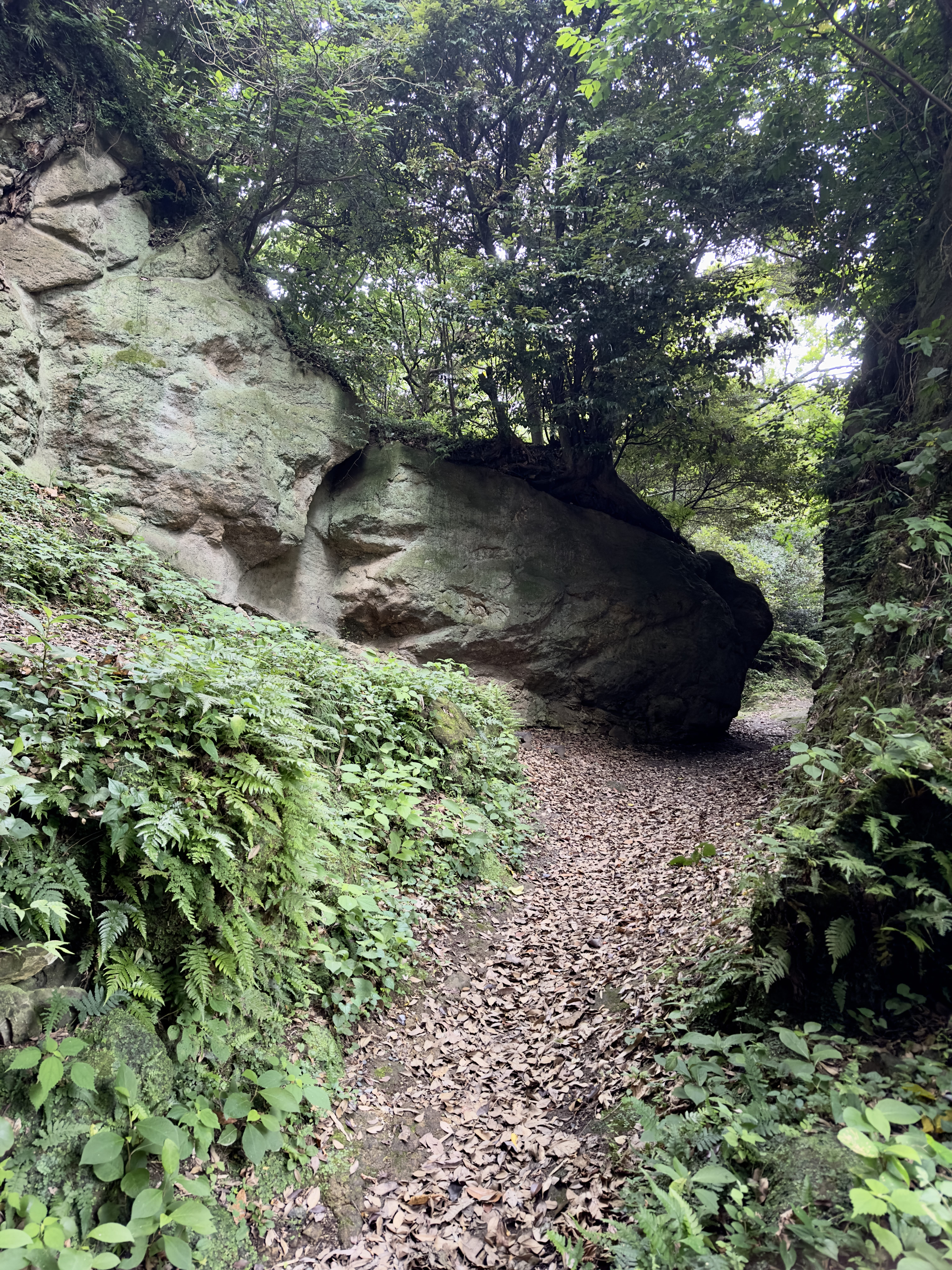
On Saturday 15th July 2023, I did this solo hike from JR Zushi to JR Kita-Kamakura, via the "Nagoe Kiridoshi" (名越 "Nagoe" place name 切 "Kiri" cut 通 "Doushi" route or way), one of the seven ancient passes cut into the mountains surrounding Kamakura to make it easier for people and horses to pass.
The news said the heat was going to be brutal, so, wanting to be out early, I packed the evening before buying some energy and protein bars at the local supermarket, and was up at 4:30am to get a quick shower and apply sunscreen and insect repellent. It was supposed to be very hot that day, and remembering how waterlogged I was the last hike in trousers and seeing some trail runners in shorts, I opted for running shorts and extra bug spray. On my way by 5:30am, I rode the scooter to, and parked at a 24 hour lot at JR Ofuna. From there, I took the JR train two stops south to Zushi and went out the north exit.
After firing up Geographica and Apple Watch Fitness (Hiking), I started jogging at around 6:30am, and it was overcast but already high humidity. Until you get to the Nagoe Kiridoshi trailhead, it's just normal concrete roads, so I decided to take a peek at a recommended temple, Gandenji, which was beautiful and very quiet. There were some cool-looking stone stairs going up past the temple, but we'll leave those for another day. I turned back down the path, jogged back to the main route 311 again, and went up toward where the trailhead for the Nagoe Kiridoushi should be.
Google Maps Directions said I had to go through the famous "ghost spot" Kotsubo tunnel to get to the stairs that lead up to the trailhead so through I went. I'm happy to report I did not see any ghosts, feel any odd cool breezes, or hear any sudden buddhist chanting or jingly bell sounds or anything like that, go figure! Once through the tunnel, the stairs are up around the bend to the left. You schlep up quite a lot of stairs, up and around, and after going through a neighborhood at the top, there's the trailhead at the edge. The sign says you can access the Nagoe Kiridoushi from here.
The trail itself is typical of the "Kamakura Alps" area, hardpack with roots and rocks, and in the case of these trails, pretty overgrown with lots of fallen trees to clamber under or over. There are signs here and there warning about snakes, so you want to keep an eye peeled, although I did not see any. It was not muddy, I assume due to the recent heat. Trail runner shoes are fine for this trail. If you don't like bugs, bring poles to wave at the plants that you're going to be brushing against. I'd also say this trail is dog friendly, except it might be a challenge with the fallen trees, and I'd wait until the fall months to bring along Taro.
Once on the trail, there were some explanatory signs for the Nagoe Kiridoshi saying it and others were the primary route for people going up Sagami bay to Kamakura, until the JR Yokosuka line was built. It's just stunning to think of how much work it would have been to physically cut a pass in a mountain like that. Really impressive.
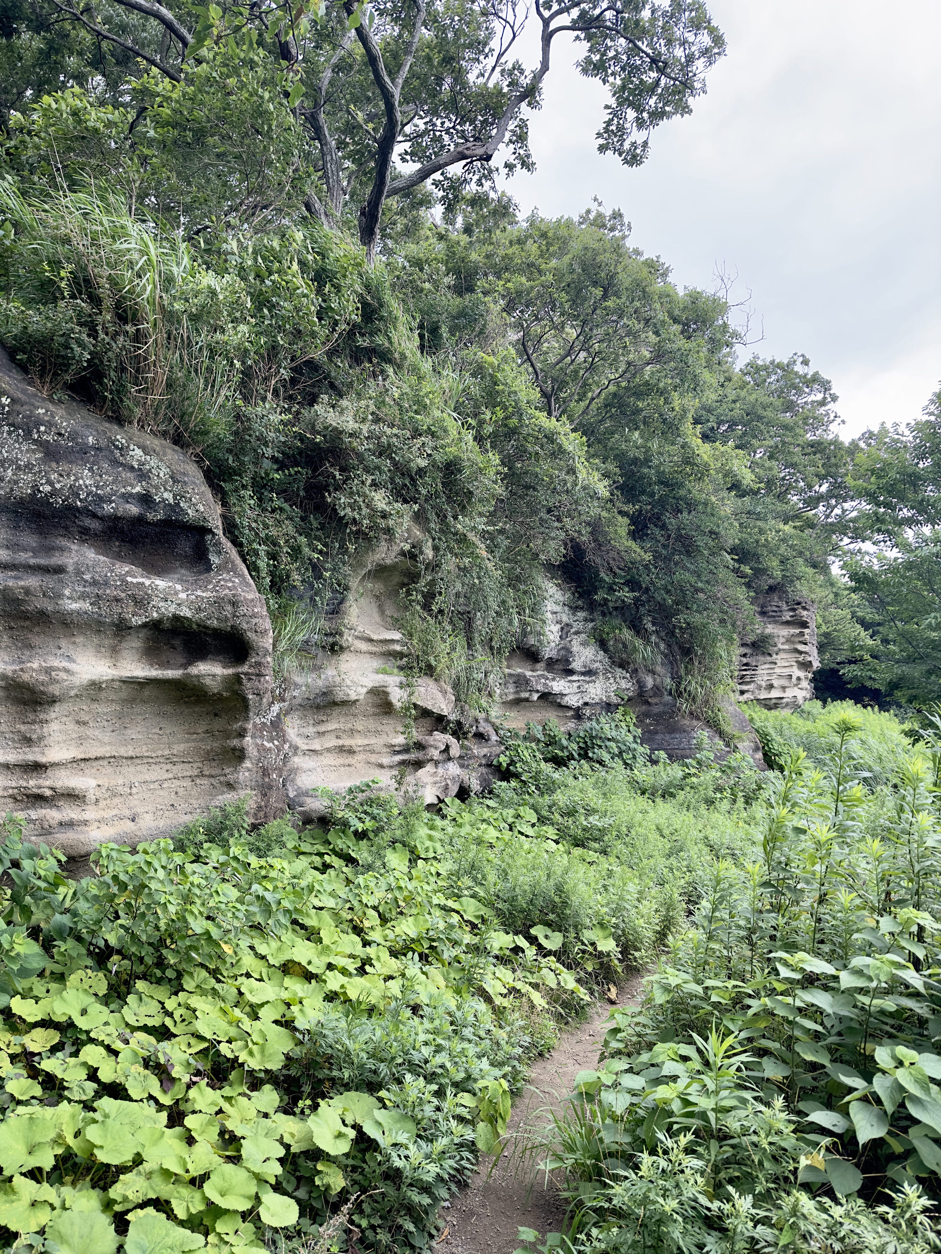
The Mandarado Yagura tombs were closed, so I did not get to see those, but I did pass through another impressive area, the Osarubatake Quarry. It was mistakenly thought this might have been a defense structure for Kamakura, but excavation and research in Heisei showed it was a quarry for stones used in works around Kamakura. It's 800m long and about 5 to 10m high, and leaves a lasting impression.
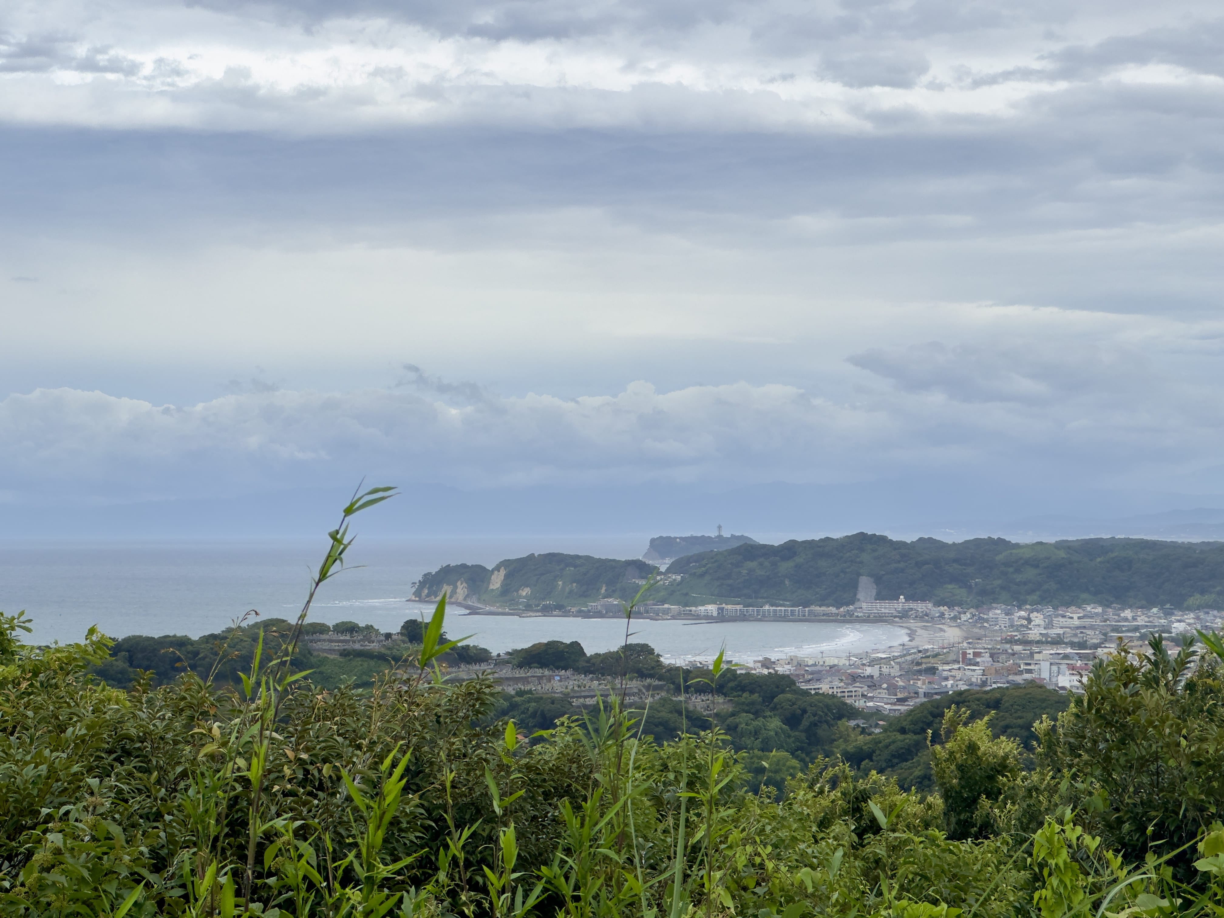
A bit farther on, there's a small sign that just said "Panorama" so I took off up a side trail, to the top of a peak, from where you could see the beach near Kamakura, and Enoshima island in the distance. It was windy and chilly up there, a relief because the clouds had cleared by then and it was starting to get hot.
From the panoramic view, it was down into the Zushi Highland neighborhood area (there's a toilet at the trailhead), then right back up onto the Heisei Pilgrimage Road trail. It's a lot of up and down, and the trail was pretty overgrown, with a lot of fallen trees here and there along the way. You exit the trail and go down the street, where you run into the "Dengakuzushi no michi" road near the Nameri river. I went west from there on regular streets, to Tsurugaoka Hachimangu, the major shrine in Kamakura, then north to Kita Kamakura and back to Ofuna by train.
All in all, about 10km, and a historically interesting jog and hike. In cooler weather, there are many more side trips you could do such as visiting Kenchoji. I guess the bug spray worked, too! Hope to see you on the trail! 🥾
See the photo gallery.
Route map, click for Google Maps:

Nagoe Kiridoshi:

Osarubatake Quarry:

View from Observation Area:
