Mt. Myojogatake - Hiking Hakone
August 16, 2023•1,028 words
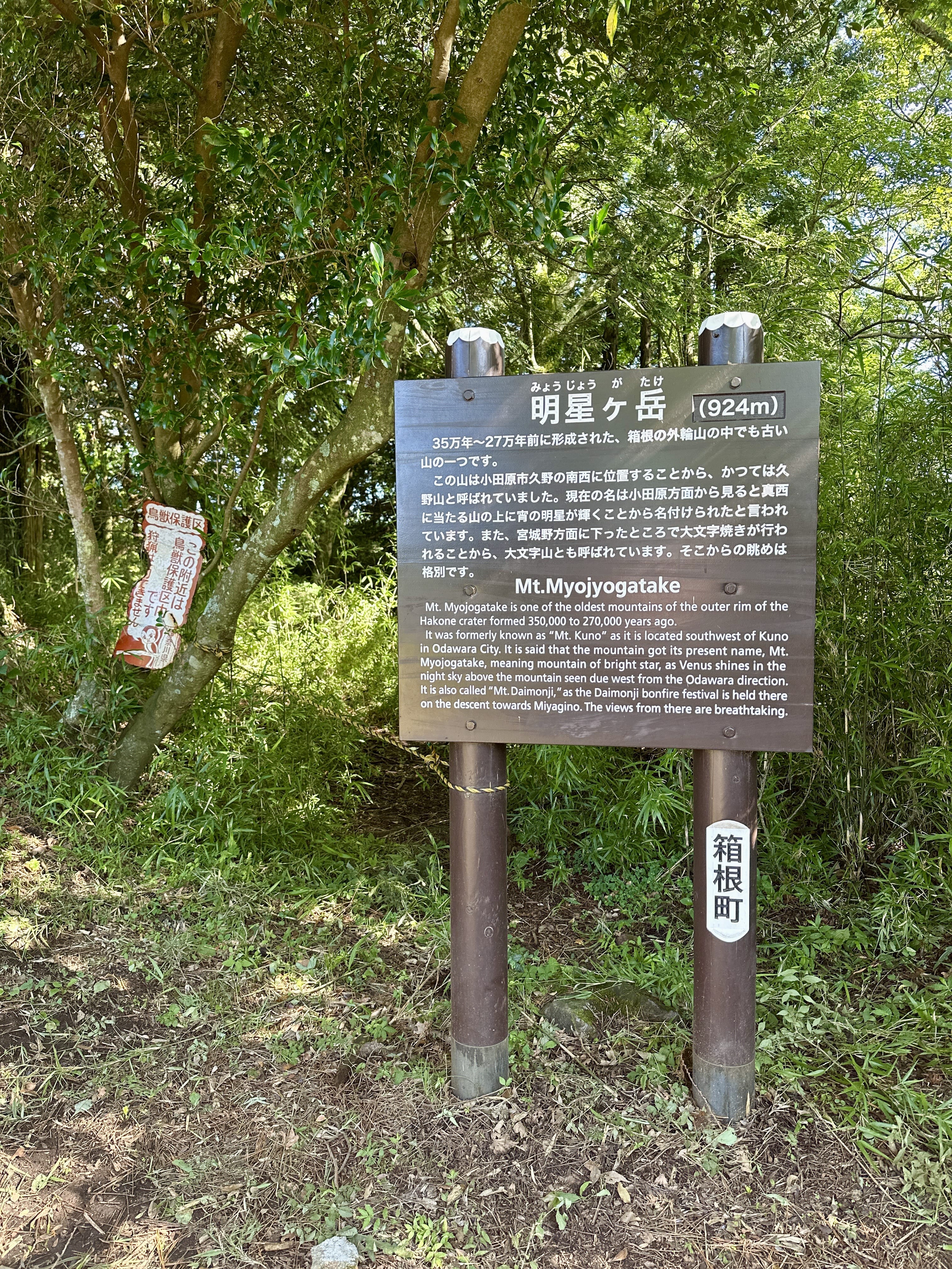
On Saturday 12 August 2023, I did a ~4hr ~6.7km solo hike in Hakone on a humid day, ascending about 570m to Mt. Myojogatake (明星ヶ岳 みょうじょうがたけ 923m) from the Miyaginobashi bus stop, heading towards Mt. Myojingatake then down toward the Miyagino Annaijo bus stop.
Mt Myojogatake is one of the stops on the gairin "outer rim" (外輪 がいりん) of Hakone, and you might meet trail runners attempting to complete that brutal course. If you’re a "normal" person with decent fitness, you'll find this hike up to Myojogatake just right. No need to attempt to run it! Although summer in Japan brings intense humidity and lots of pestering insects.
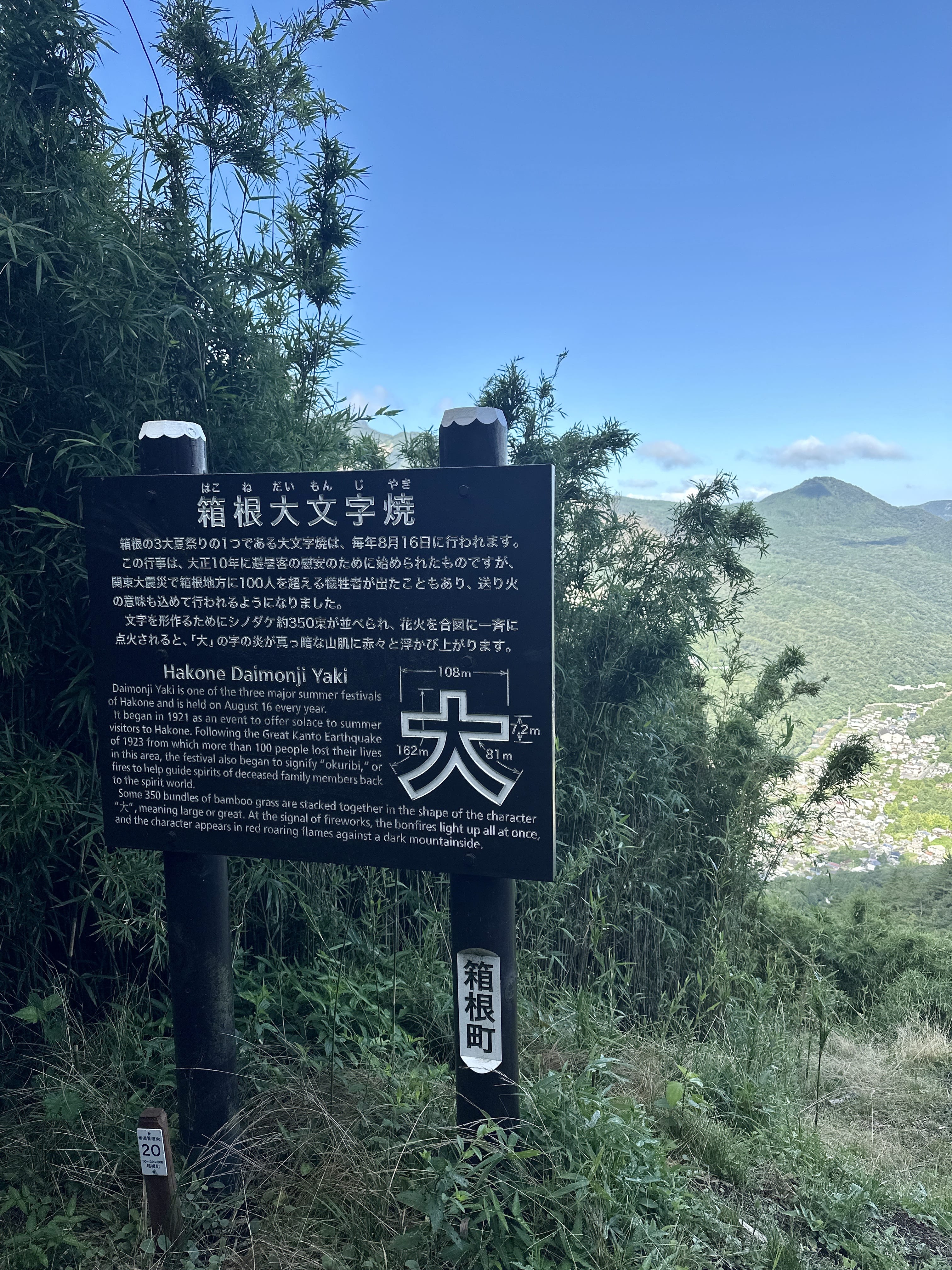
From the placard at the summit, you'll read it gets its name "Myojo" from Venus, the morning or evening star. It's also known as Mt. Kuno, from its vicinity to the Kuno district, and Mt. Daimonji, from the main event at the annual Hakone Gora summer festival held on Aug 16th at the end of o-bon, when a giant 10m wide "dai" kanji symbol, 大, cut into the side of the mountain, is set alight. After the initial ascent, I got passed by a young fellow carrying a gas-powered weed whacker on his shoulder, then later ran into him and two other older men with various gardening gear, who said they were cleaning up the giant 大 in preparation for the festival. I was glad for my desk job right about then, but also a little jealous of such a cool activity prepping for such an important cultural event.
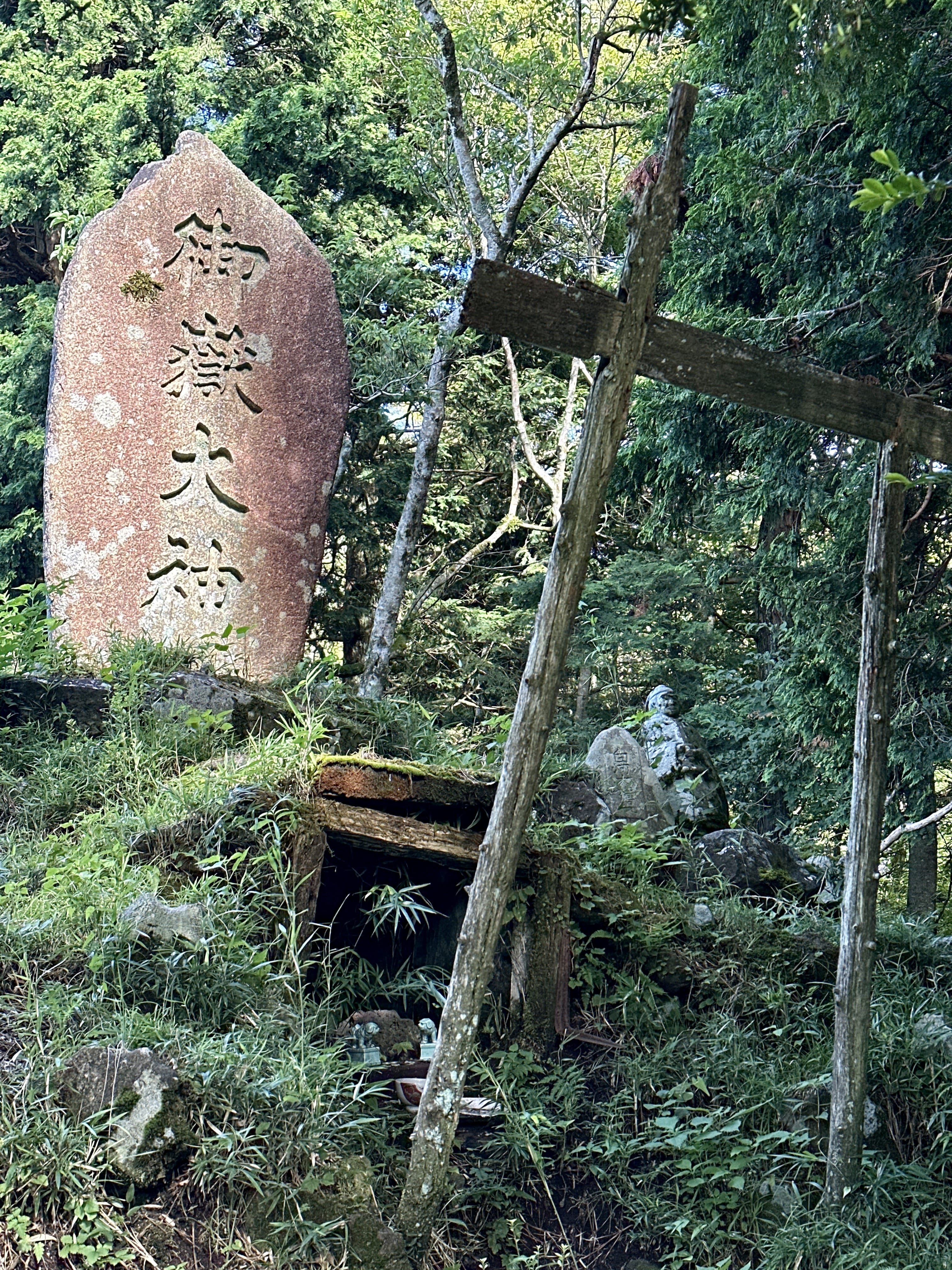
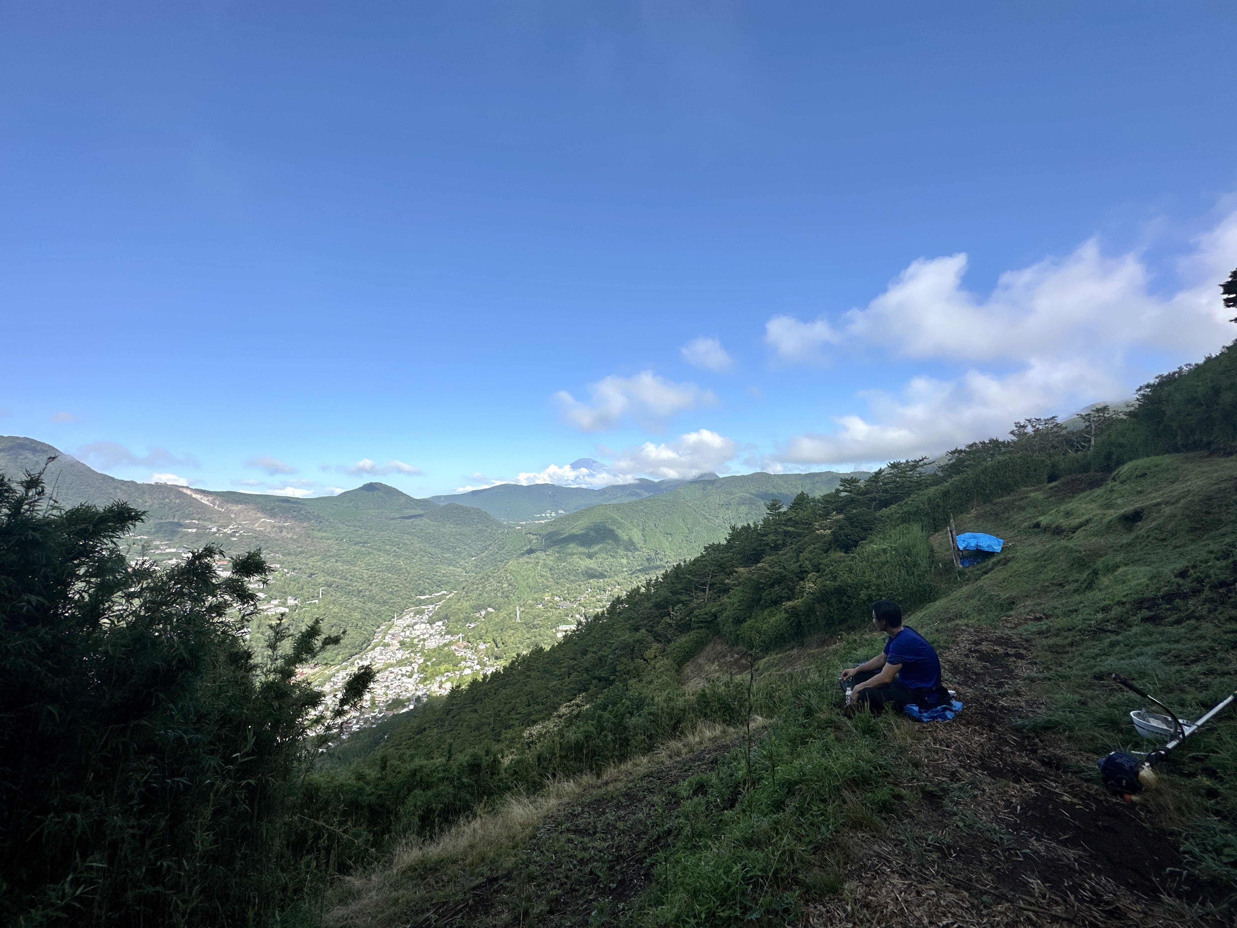
The summit is pretty enough, with a manicured grassy open area (no toilet), and a small shrine next to the summit placard, but the views are not really spectacular. For that, hike to the next peak over, Mt. Myo-jin-gatake, or a little further on, to Mt. Kintoki. The views from the "dai" area are nice though, and you can see Gora, the ropeway, and Mt. Hakone and its surroundings quite well. To be honest, I just wanted to do a hike, so I picked this trail and this mountain, then figured out where I was when I got there. It was cool to learn where the giant 大 symbol is physically, see how it's maintained, and read a little about the mountain.
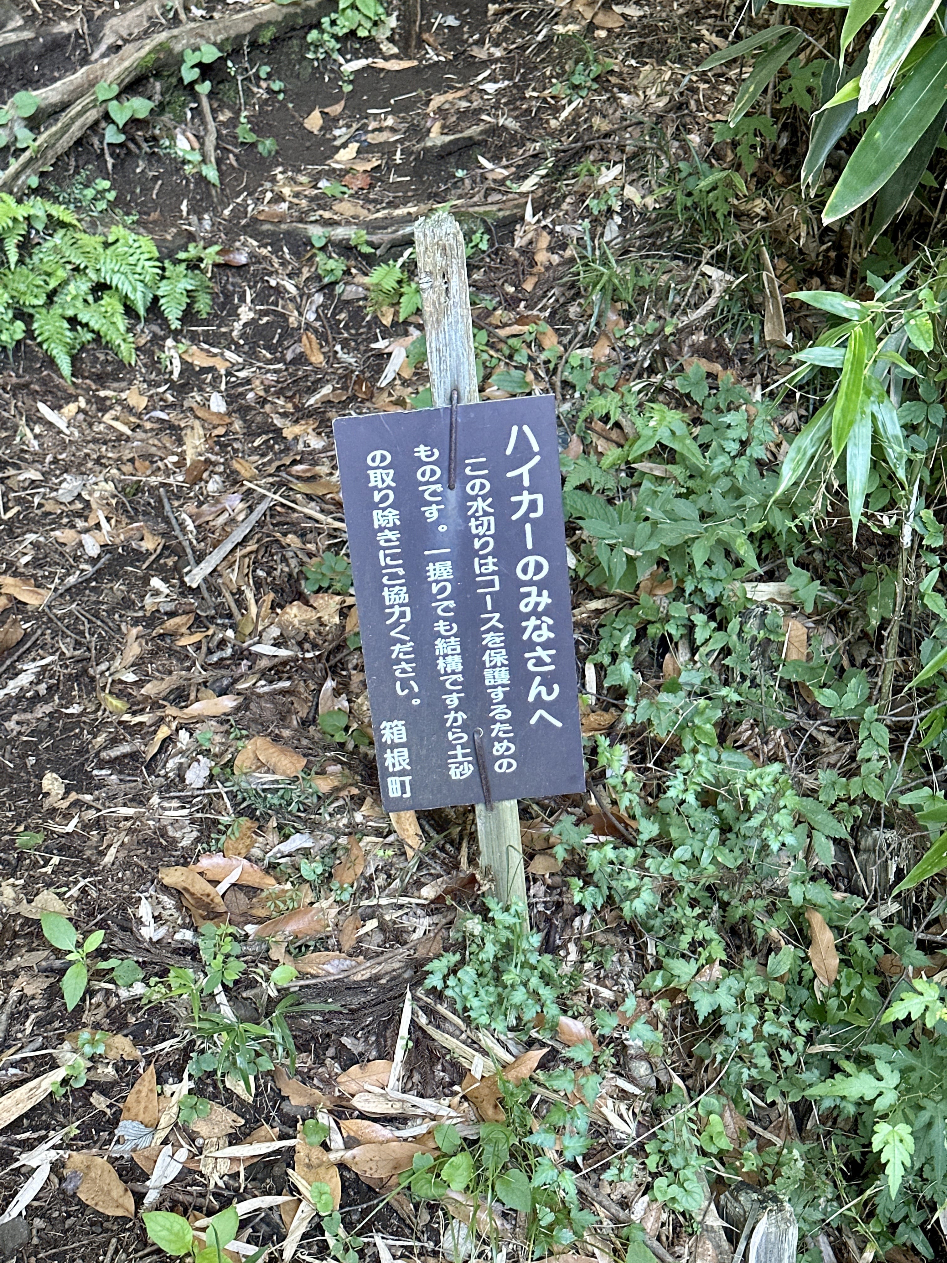
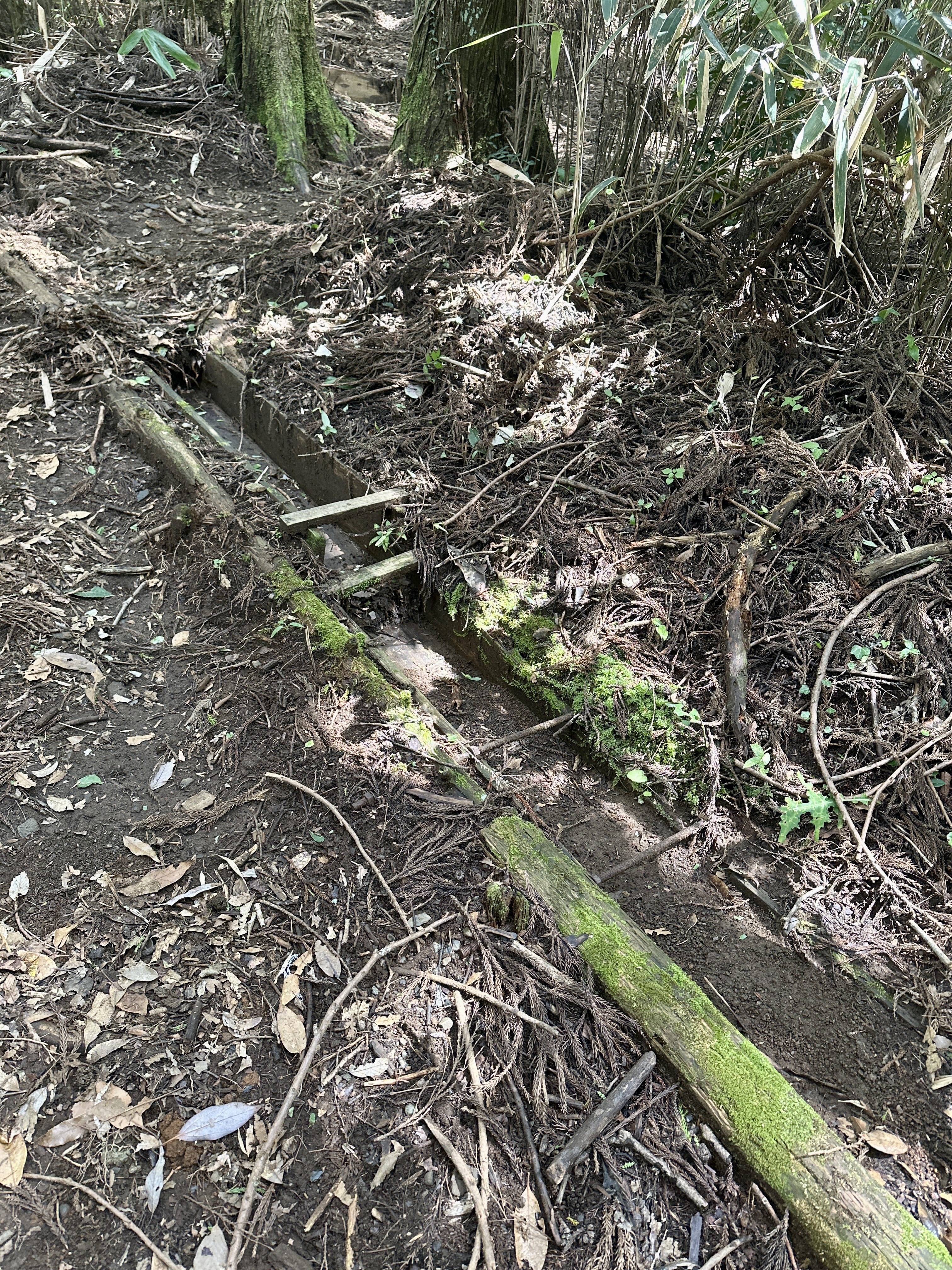
There were no "paving stone" sections like you see on the Yusaka or "Old Kamakura" trail from Yumoto up to Mt. Sengen, but otherwise the trail was typical for this area: hard pack dirt with a lot of roots and rocks, mostly larger ones, and some steps made from cut logs. Also, I saw a sign again and finally figured out what it meant. The sign says to scoop up even a handful of dirt from the "water channel", and what is meant by that, is there are channels cut across the trail to allow water to pass, which get filled with dirt and silt. They are asking hikers to grab a handful and toss it aside, so I did. You can see the sign and said water channel in the photos.
The descent was uneventful except for one area where it was too much of a drop (for me) to maneuver myself down, so I dropped my poles and pack down onto a flat area, turned around, and somehow lowered myself down. I find fear creeping into my thoughts in these situations, so I know I won't be hiking something like Mt. Tsurugi anytime soon! You'll probably find trekking poles to be useful on the descent.
I was on the trail by 6:45am, and while there was a lot of bird song, which was pleasant, there were also a lot of flying insects this time. Some bees, some hornets, and some large flying insects which were really persistent; they looked like large flies with a white spot on their abdomen. A friend told me about a saying that goes something like "the mountains are ours in the mornings but theirs at night." He said he started out on some Hakone trail around noon, and said he felt monkey eyes on him as he descended near dusk. Said it was a creepy experience he doesn't want to repeat. Yeah, I think I'll leave before sunrise in the future too.
As you get to the trail head after descending, you start seeing signs for the bus stop and public toilets. The Miyagino Annaijo bus stop maintains a public restroom, which I used before getting on the bus and heading down to Kami-Tonosawa bus stop. From there I walked a little bit up to Hakone Yuryo, a day-spa onsen for a post-hike soak and a meal. (It's a fantastic facility, but like many others, they don't admit people with tattoos FYI) From Hakone Yuryo, I used their convenient shuttle to go to Hakone Yumoto, then took the funicular to Odawara and took the JR train back home.
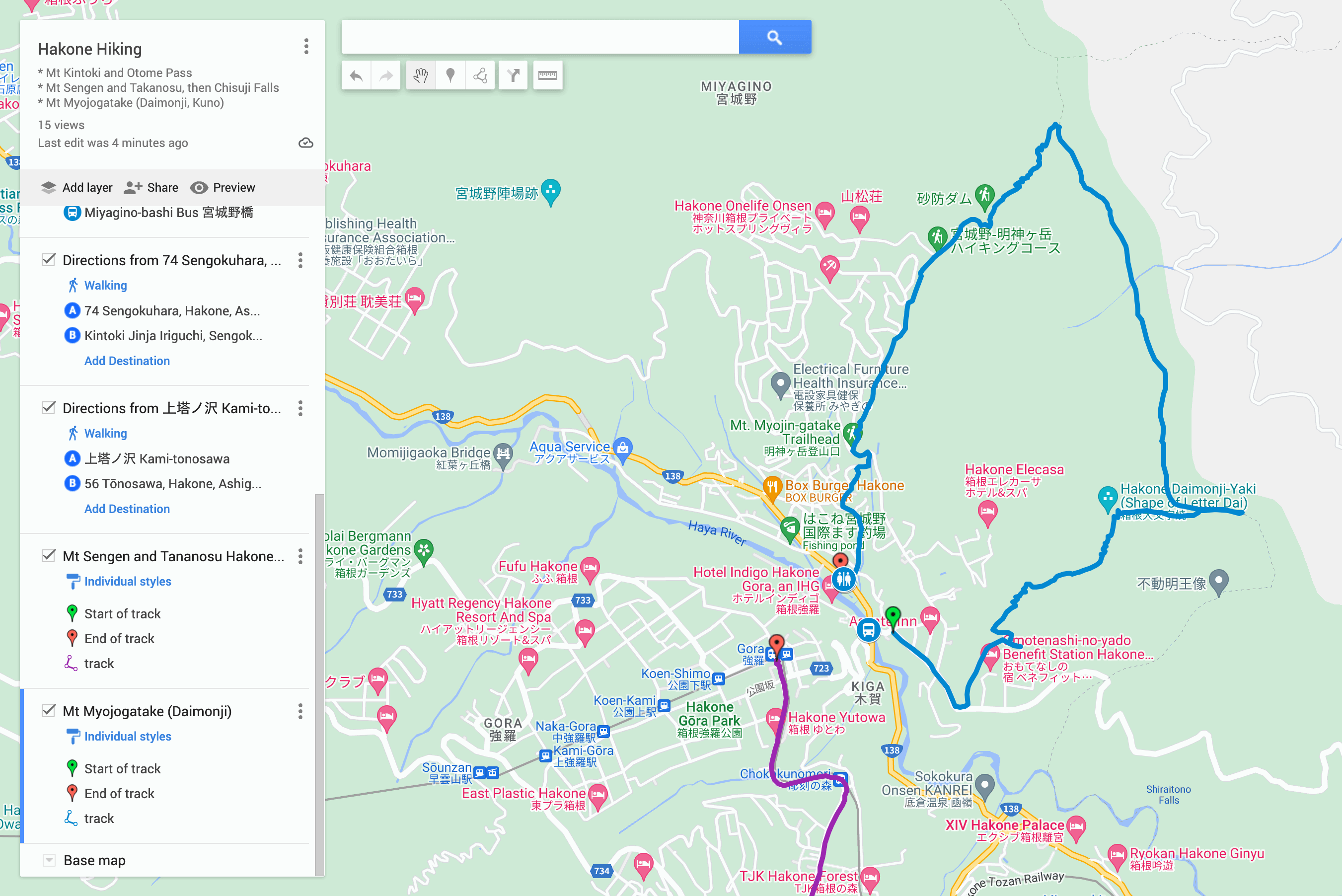
At any rate, if you're interested, check out the route map on my Yamareco activity URL. Hope to see you on the trail some time! 🌋
See the photo gallery and Yamareco activity record.
Route map, click for Google Maps:
Sign asks hikers to clear even one handful of dirt from the water clearance channels cut across the trail:
One of many water clearance channels on the trail:
Placard at the "dai" character that gets lit up during the o-bon festival:
He is one of the folks who prepare the dai character before the festival, weed whacker at right:
Mt Myojogatake summit placard gives a little history and information about the mountain:
At the summit of Mt Myojo there is this small shrine: